Palo Verde National Park
Palo Verde National Park
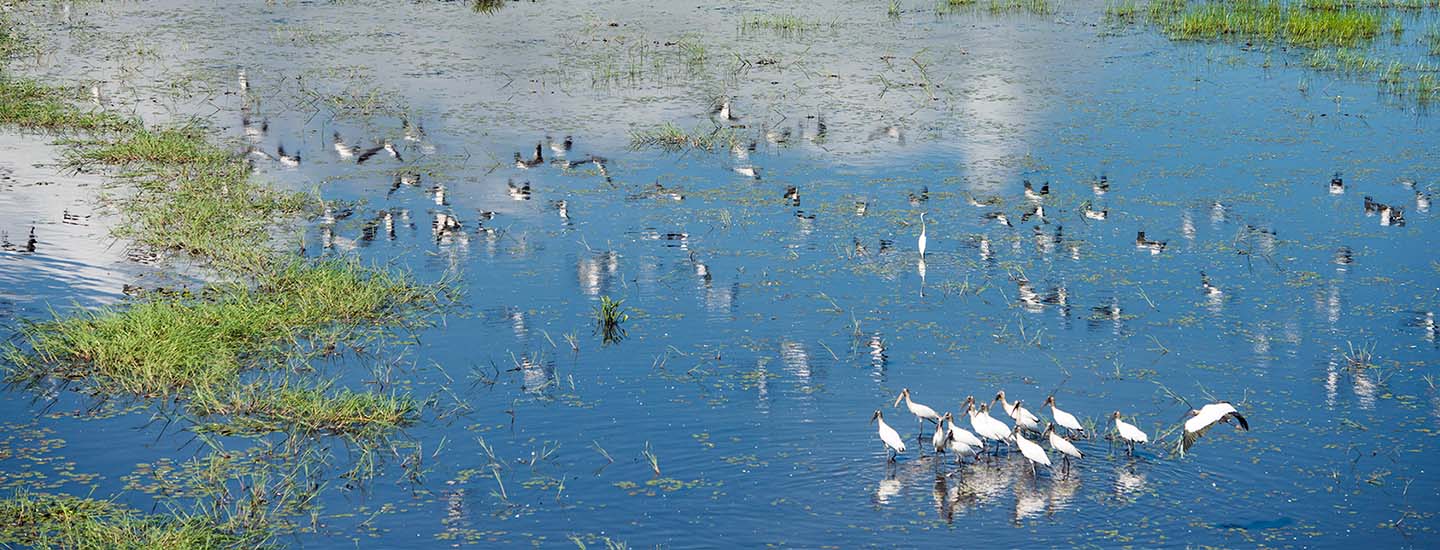
Palo Verde National Park is one of the most biodiverse areas in Costa Rica. It encompasses a rich mosaic of over 15 different natural communities, including the deciduous lowland forest, the evergreen forest, the flooded forest, the deciduous limestone hill forest, grasslands and mangroves. The wetlands, which represent some 50% of the park’s area, are a sanctuary for thousands of aquatic birds, both migratory and non-migratory. This led the park to be declared a Wetland of Importance under the Global Convention on Wetlands. Incredible resources Over 750 species of plants have been identified, including the palo verde, pochote, Spanish cedar and the Guanacaste tree. In addition, 5 of the 6 species of mangrove present in the country can be found in the park. In terms of fauna, over 280 species of migratory and non-migratory birds have been identified, some of which are endangered or whose populations have been shrinking, such as the scarlet macaw (Ara macao), jabiru (Jabiru mycteria), great curassow (Crax rubra), along with the long-tailed manakin (Criroxiphia liniaris), caracaras (Polyborus plancus), ducks (Anas spp.), grey herons (Casmerodis albus), among many more. In terms of amphibians and reptiles, the park inventory includes around 55 species, including the frog-eating snake, boa constrictor, the South American rattlesnake (Crotalus durissus) and coral snake (Micrurus nigrucintus), along with crocodiles, iguanas and alligators. Main attractions Various trails, called Senderos in Spanish, can be found in Palo Verde, which offer visitors a unique experience: SENDERO LA ROCA: This trail takes you on a 540 meter circuit to a lookout from where you can see a large portion of Palo Verde’s lake, as well as the majestic Río Tempisque and the Gulf of Nicoya. SENDERO EL GUACAYÁN OR CERROS CALIZOS: This is a challenge for the more adventurous spirits. A steep trail, 1,460 meters in length, takes you to the Guayacán or El Cactus lookouts, from where you will be able to observe Lake Palo Verde and the tempisque flatlands. SENDERO LA CANTERA: A 1,400 meter tour in which you will be taken on an intense emotional journey through nature until you reach a beautiful lookout from where you will be able to observe the serpentine Río Tempisque. EL MAPACHE: This 710 meter trail through the forest will show you three different habitats: the lowland deciduous forest, the limestone forest and the evergreen forest. LA VENADA: At 2,100 meters in length, this trail borders Lake Palo Verde on some of its stretches. SENDERO EL PIZOTE: With a length of some 650 meters, it offers visitors the opportunity to admire enormous trees and to enjoy the impressive dryland vegetation as they ascend the trail. La Jacana boardwalk: Walk above Lake Palo Verde over an 80-meter-long path with a special birdwatching area. Other attractions Isla Pájaros 2.3 hectares in area, this island is the nesting ground for at least eight species of birds, including the country’s largest colony of the black-crowned night heron. The island is located on the Río Tempisque, meaning that it can only be visited by boat. Laguna Palo Verde An excellent birdwatching site. From September to March, thousands of herons, egrets, ducks and northern jacanas, among others, flock to the lake and neighboring areas to feed and reproduce, creating a unique space. This lake contains a 20 meter boardwalk that has become one of the best spots for birdwatchers, researchers and the general public. Ríos Tempisque y Bebedero Sections of both rivers form the natural limits of the park. They are navigable waterways during high tide, and a wide variety of aquatic and riverine fauna can be observed here, including birds, crocodiles, iguanas and turtles, among others. There are park entrances on both rivers: Chamorro via Puerto Humo and Catalina via El Bebedero. Acceso: Via Route 1, Interamericana Norte (asphalt highway) to Bagaces. Then 30 km south from Bagaces on a year-round gravel road. The park can also be entered from Nicoya via Puerto Humo.
