Poás Volcano
National Park
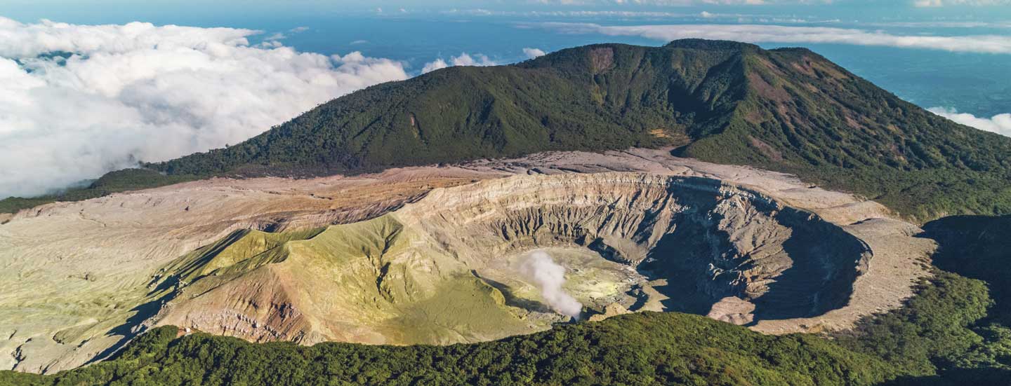
Poás Volcano National Park
The Poas is a volcano that rises to 2,708 metres above sea level, since 1989 has increased markedly the emission of gases causing acid rain phenomena that have damaged the flora in some sectors of the Park and surrounding agricultural plantations to the area. At the top there are two craters, the principal of 1.5 km in diameter and 300 deep, and the Botos lagoon, cold water and source purely rain, that drain into the Caribbean by the Angel river, tributary of the Sarapiqui River. Today the volcano emits large amount of gas and water vapor from the different fumaroles that are located in the inner cone of the crater. Identified several volcanoes, the Chompipe 2259 m above sea level, the Turu 2139 metres above the level of the sea, Cerro Cacho Negro at 2250 m and the Barva which has several craters, the well-known Tres Marias at an average altitude of 1725 meters. Make your reservations here: http://www.sinac.go.cr/EN-US/Pages/default.aspx