Tourist atractions
in Guanacaste
Tourist atractions in Guanacaste
With a total of 5,921 sq. miles and more than 400 miles of coast line, Guanacaste comprises the Pacific Coast area from the border of Nicaragua to the Bongo River estuary in the Nicoya Peninsula. This area is home to a very important section of Costa Rica’s cultural and natural heritage and boasts a significant number of protected areas including water, land, mountain and coastal ecosystems.
The incomparable beauty of its landscapes, warm climate and flourishing nature make Guanacaste one of the most popular and most visited destinations in Costa Rica.
Along the Guanacaste coastline are a number of beaches perfect for swimming and enjoying the warm Pacific Ocean waters. The coastal landscape is exceptional with its array of white-sand beaches and calm, intense-blue waters.
-
Guacamaya beach
This is a beautiful beach with soft waves and a coastline full of vegetation as well as a beautiful ocean view with little islands scattered about. This place is ideal for sunbathing, swimming, rest and relaxation. It’s also excellent for hiking and taking great photos.
-
Grande beach
This beach is part of the baulas national marine park. Its name comes from its extensive beach, which extends south the Tamarindo estuary where there is a beautiful mangrove (Tamarindo wildlife national refuge) which can be traveled to by boat. This beach is especially popular among surfers and those who want to observe the leatherback sea turtle nesting area. This area is also good for sunbathing, hiking, and swimming. It carries the blue flag ecological certification.
-
Blanca beach (Flamingo)
Blanca beach is a secluded white sand beach cove suitable for swimming. It has a mangrove swamp and to the north, the bays of brasilito and potrero are separated by plata island and Punta Salinas.
Spectacular views can be enjoyed on both bays. Its scenic natural beauty, as well as the excellent variety of services offered, makes blanca beach ideal for those who want to enjoy the beach during the day and be entertained at night.
-
Danta and pan de Azúcar beaches
These beaches are two inlets less than a mile long and surrounded by hills from which visitors observe a magnificent panorama of the brasilito and potrero bays. These beaches have calm waters, making it ideal for swimming. From Danta beach the Pitahayas islets and the santa catalina islands are visible, which are popular among divers.
-
Coyotera beach
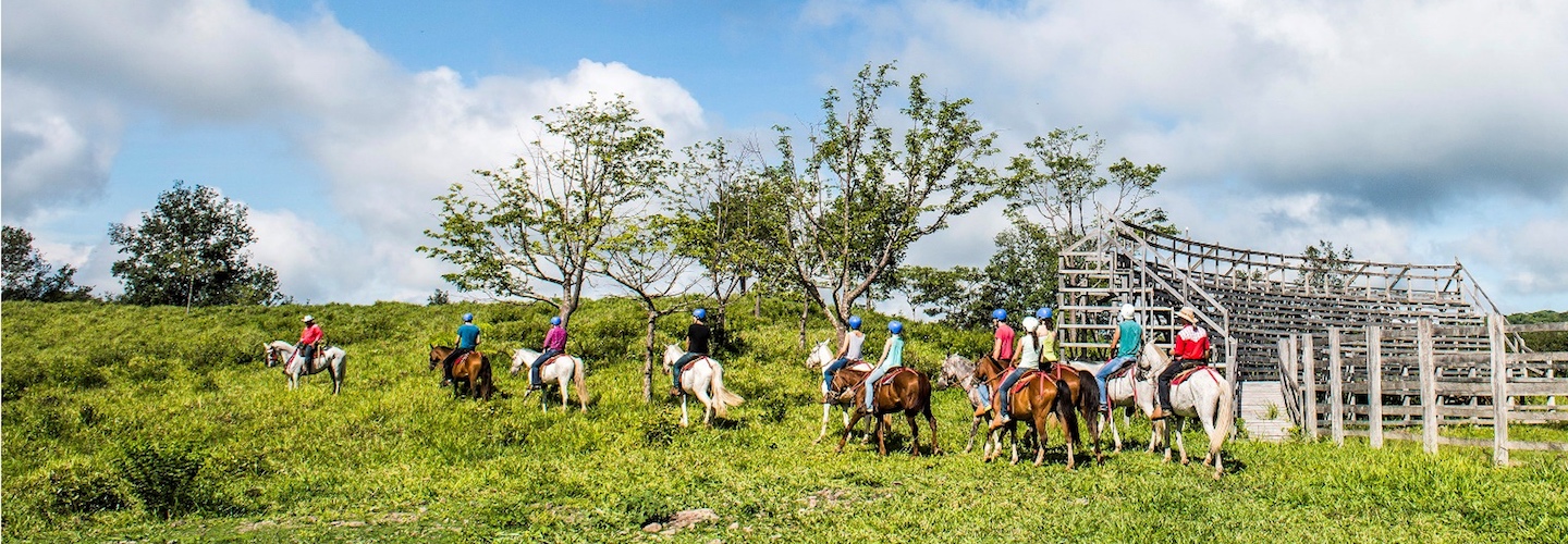
This is an extensive beach with the bolaños islands directly in front of it, which can be reached by boat or kayak. During the windy months, it is a great place for windsurfing. It is also ideal for relaxation, hiking, and horseback riding, as well as exploring nearby areas by mountain bike.
-
Conchal beach
This beach is located south of Brasilito, which is separated by a rocky headland (Punta Conchal), from which there is a beautiful panoramic view of the beach and the entire coastline to the south. This inlet is about a mile long and gets its name from the beach composed of millions of shell fragments. It is lined with lush vegetation, a mangrove, and crystal clear waters. It is one of the most beautiful beaches in the country and is ideal for swimming, hiking, horseback riding, boat excursions, and other water sports, including diving. This beach has been awarded the blue flag ecological certification, which identifies it as a clean and safe beach.
-
Coco beach
This is one of the most popular and traditional beaches in Costa Rica. It is located in a bay with gentle waves and is very suitable for swimming and boat docking. To the south there is the centinela islet where there is a cove with white sands. Coco beach has a wide range of recreational and sporting activities, including sportfishing, diving, boat excursions, hiking and horseback riding.
-
Chorotega beach (Panama)
This is a wide bay lined with fine sand bordered by the trees from brazil, manchineel trees and mesquite trees. The waters are calm which make it a popular beach for swimming and camping.
-
Brasilito beach
This beach, along with Bonchal, makes up the Brasilito bay. Depending on the area, the waves range from gentle to moderate. It is an ideal beach for sunbathing, swimming, hiking, watching the ocean and the beautiful sunsets.
-
Blanca and virador beaches
Blanca beach has crystal clear water and soft waves. From its coastline visitors see the beaches of Monte del Barco and Chorotega.
Blanca beach and Virador beach which form a natural bridge that connects to punta mala. Virador is a beautiful inlet with white-sand beaches and crystal clear waters, ideal for swimming and diving.
-
Blanca beach (Flamingo)
This is an inlet with moderate waves, which makes it suitable for swimming. Thanks to its scenic and natural beauty and exciting nightlife, it is ideal for those who want to relax on the beach during the day and party at night.
-
Avellanas beach
This beach is located 2 and a half miles south of Langosta. It has a rocky coastline that extends several miles and is lined with coastal vegetation. There are strong waves with two different areas great for surfing. Other activities include hiking, swimming, and looking for little fish and mollusks in the tide pools during the low tide among the rocky areas.
-
Farallon National Monument
Located on Las Lomas estate, “El Farallon” is an enormous rock wall, 60 ft. long, and full of indigenous engravings, which was declared a National Monument in 1998. The petroglyphs, according to studies, were created by indigenous people in 800 B.C. In order to get there, visitors enter Cañas and head to the Sandillal. From there the road gets a little treacherous and at certain places it is little more than a trail. Once on the estate, visitors will be welcomed by the Lopez brothers, who will accompany them to “El Farallon,” located on the Cabuya River. The monument is open to the public every day from 7 a.m. to 5 p.m. For questions, visitors can call (506) 8911-8680.
-
The Popular Bull Ring
In almost every town in Guanacaste, bull riding is an extremely popular sport. Riders include men, young people, and sometimes even children.
-
Our Lord of Agony chapel
This picturesque chapel represents typical Colonial architecture constructed in adobe, which is relatively uncommon these days in Costa Rica. The construction of the building dates back to 1850, and has been declared a historical and architectural landmark.
-
Eco-Museum of The Abangares Mines
The eco-museum is located on a 22 acre piece of land and showcases the Gunpowder House, the foundation of the hammer shops, the walls over which the train passed, the quarry, and the machines used to mine and transport gold. This is a historical site, both socially and economically, when Minor Keith was the owner of the Abangares Gold Field of Costa Rica. It is located in the Abangares Mountain Range; visitors enter through Las Juntas and it is open from Tuesday to Sunday, 8 a.m. to 3 p.m.
-
Fieldworker and Cook Day at The Santa Rosa Ranch
Celebrated in Santa Rosa National Park on the second Sunday of November. A mass is held in honor of fieldworkers and cooks that work on the ranch. Afterwards, there is a bull run, and activities involving field work chores, food and music.
-
Liberia
Liberia is known as the White City. It is a typical colonial town with wide streets, old buildings, and bahareque homes. This city is a combination of old structures, customs, and traditions plus modern facilities such as malls and business services. The last few years have seen new urban development such as the Daniel Oduber International Airport, which receives commercial and charter flights from numerous cities in Canada, the United States and from other parts of the world.
Liberia is home to the national parks of Santa Rosa, which is close to the small town of La Cruz, Rincon de la Vieja, and the beaches around the Gulf of Papagayo. Enjoy the Guanacaste National Band on Fridays and Sundays at 7 p.m.
-
Las Juntas
Las Juntas is a gold-mining town lined with cobblestone streets, not far from the Monteverde Biological Reserve and the neighboring towns of Santa Elena and Tilaran Among the more popular attractions is the Abangares Mines Eco-Museum, in the town’s park where there are locomotives which were used for transporting gold.
-
Cañas
Cañas is 282 ft. above sea level and home to the Corobici River, which is a favorite among adventurous tourists and naturalists. The Pelado Volcano and “El Farallon” archeological site are also located in Cañas.
-
Celebrating Cultural Week in Liberia, The White City
Cultural Week is celebrated in Liberia during the first week of September, when Guanacaste was originally founded back in 1836. The event has been held for 17 years by the Cultural Association, and every year has a different theme such as education, culture, and architecture. There is always music and dance activities, art from Guanacaste, and typical foods and drinks.
-
Llanos del Cortes Waterfalls
These 30 ft. high waterfalls are surrounded by lush vegetation and form a beautiful sheet of cascading waters descending into a pool below. Perfect for swimming, it also has a unique little white sand beach.
-
Liberia River Canyon
A few miles from Liberia and on the road that leads to Santa Maria in Rincon de la Vieja National Park, is a deep canyon formed by the Liberia River. From the canyon visitors can see the Rincon de la Vieja Volcano.
-
Main Street in Liberia
Ancestral, white-colored homes made of adobe, bahareque and lime line the historic district of Liberia and give the city its identity.
-
Cuajiniquil Bay
This bay is well protected against the winds and is home to a beautiful mangrove. It is often frequented by fishermen looking for a safe place to dock their boats.
-
Traditional Passing Of The “Niño Dios” (Child Jesus) In Liberia
This is a long held tradition during which a number of people from Liberia venerate the “Niño Dios” (Child Jesus) statue belonging to the family of Valdelomar Baltodano. It starts with a drink made from chicha (fermented corn) and pinolillo (cornmeal and cocoa based drink). The statue is carried to the Our Lord of Agony Chapel, where it is displayed and admired. Mass is then held around 10 p.m.
-
Tempisque River
This river originates in the foothills of the Orosi Volcano and is about a hundred miles long. Some of its tributaries are the Colorado River, Salto River, Bebedero River, Bolson River, Diria River, and Cañas River. It is navigable and teeming with many species of birds. At the lower end of the river is the Palo Verde National Park.
-
Corobici River
This beautiful river located a few miles north of Cañas can be navigated by canoe. Its rapids are Class I and II, which is ideal for anyone who is interested in beautiful scenery, herons and toucans and other exotic species of birds.
-
Doors of The Sun
In Liberia and other towns in Guanacaste, it is customary to build homes with two corner doors, which is an interesting feature and unique in Costa Rica. Because they were designed to let the sun in, they have been given the name, Doors of the Sun. The majority are found in the center of Liberia.
-
La Amistad bridge
In April 2003, this bridge was inaugurated in order to replace the ferry that was used for many years to cross the river. It is a very important engineering project, designed with the help of the Taiwanese government. It measures 2,550 ft. in length and serves as an important feature for the development of Guanacaste.
-
Ventanas Beach
This inlet is located northeast of Grande Beach which is linked (and separated) by a rocky cliff. This beach is suitable for sunbathing, swimming, relaxing and hiking north to Carbon Beach.
-
Rajada Beach
This is a soft-wave beach, ideal for swimming, it is also ideal for relaxing under the shady trees that line the beach, hiking and taking pictures.
-
Puerto Soley Beach
Located in the far northern region of Guanacaste in the beautiful and extensive Salinas Bay, Puerto Soley Beach is a very popular beach among locals from La Cruz. It has moderate waves and soft sands and is famous for its sunsets. It’s also a great place for hiking or simply admiring the majestic scenery of the bay.
-
Prieta Beach
This is a small beach to the south of Pan de Azucar. Here are soft waves and an abundance of coastline vegetation. To the south are Punta Prieta and the Chocoyas Islet.
-
Potrero Beach
This is a bay with calm waters, estuaries, mangroves and beautiful views. To the far south, are the Flamingo Marina (Blanca). Potrero Beach is ideal for swimming, diving, sunbathing, hiking, horseback riding, and more.
-
Penca Beach
This is another small beach with moderate to strong waves. It has an estuary and a mangrove, which, along with the Chocoyas Islet in the far north, gives this beach a very special natural beauty of its own. It is Blue Flag certified.
-
Ocotal Beach
This is an inlet bordered by hills with grayish sands and calm waves. To the extreme south is Punta Cirial which is surrounded by crystal clear waters. The beach here is ideal for swimming, sunbathing, and water sports including, diving and sportfishing. From the peaks of the adjacent hills, magnificent views of the Gulf of Papagayo can be had. South of Ocotal is another smaller inlet known as Azul or Pez Vela Bay, which is popular for sportfishing. This beach carries the Blue Flag certification, meaning it has been recognized for its cleanliness and safety.
-
Negra Beach
This beach is located between Avellanas and Junquillal. In spite of its name, it has clear sand and a rocky coastline with excellent waves for surfing. To the south is another lesser known coastal area (Callejones) that is also good for surfing.
-
Naranjo Beach
Located very close to the ferry dock, Naranjo Beach is a small beach with gentle waves and a lush coastline. Ideal for relaxing and sunbathing, Caballo Island is just off the coast. From Naranjo, there is hiking, horseback riding and mountain biking to other nearby points of interest.
-
Nacascolo Beach
The water here is clear with soft waves and is great for swimming, hiking, and diving. It is often frequented by tourists arriving by boat from nearby hotels and other water transport businesses. Its undeniable beauty makes Nacascalo a perfect little niche in the Northern Pacific for walking along the beach and observing the small estuary located to the far south.
-
Monte del Barco Beach
This small beach is located between two points that connect it and the surrounding beauty makes it ideal for relaxing and swimming. From the sides and top of the joining hills there is a beautiful view of Culebra Bay, particularly during the sunsets. This beach carries the Blue Flag certification, meaning it has been recognized for its cleanliness and safety.
-
Langosta Beach
This inlet is separated from Tamarindo by Punta San Francisco. There are two main areas that are divided by the mouth of the San Francisco River. To the north, the coast is rocky and not suitable for swimming. To the south is the San Francisco Estuary, whose mangrove is an important place for bird nesting. Langosta Beach is also an important nesting site for the Leatherback Sea Turtle (Dermochely scoriacea) and is part of the Las Baulas National Marine Park. Hiking is a great way to observe the scenery and its diverse species of birds. Langosta is also very popular among surfers. This beach carries the Blue Flag certification, meaning it has been recognized for its cleanliness and safety.
-
Junquillal Beach
This extensive and wide open beach has a mix of scenic views and is great for hiking and horseback riding. The waves are good for surfing, for which it is well-known. Fishing and kayaking are also very popular. This beach carries the Blue Flag certification, meaning it has been recognized for its cleanliness and safety.
-
Jobo Beach
This is a beautiful and protected inlet with gentle waves. It has gorgeous scenery and is ideal for swimming, relaxing, and meditating, as well as other activities including bird watching.
-
Iguanita Beach
This is a beautiful beach located at the back of Culebra Bay. It is bordered on the far north and south by rocky tips. To the south flows the Grande Stream, which empties into the Iguanita Estuary, forming an intricate mangrove.
-
Hermosa Beach
This bay is around a mile long and has grayish sands. It is located between two rocky tips. To the south and facing Punta Cacique are the Pelonas and Montosa Islands. The waves here are very small with an abundance of coastline vegetation. It is great for swimming, sunbathing, watching the sunsets, and water sports, including diving, hiking, and horseback riding. This beach carries the Blue Flag certification, meaning it has been recognized for its cleanliness and safety.
-
San Miguel and Coyote Beaches
The access road that connects these beaches runs along the San Miguel Hill, from which there is an impressive view of the open coast. The waves of these beaches are strong and consistent. The coastline is great for small boat rides, relaxing, watching the ocean, hiking, horseback riding, as well as observing the flora and the fauna among the mangroves.
-
Samara Beach
This is a bay that measures a few miles long with moderate waves. Mangroves, Manchineel and coconut trees, and vine plants like the “frijol de playa” (beach bean) are very common here. In the center of the beach is a large old strangler fig tree for which Samara is recognized. Sunbathing, hiking, horseback riding, swimming, mountain biking, boat rides or ocean kayaking are just some of the activities this beach provides, as well as services to ensure enjoyment of the beach during the day and great music and food at night. It carries the Blue Flag certification.
-
Pochote Beach
This is a small horseshoe-shaped bay with soft waves. The surrounding coastline is very beautiful and the Palmitas Islands (Huevos) are visible from here.
-
Pleito and San Juanillo Beaches
These small inlets are abundant with coastal vegetation. Both are linked by a rocky surface that joins Punta Trinidad and Punta Pleito. Punta Pleito is ideal for swimming, as is San Juanillo with its calm waves.
-
Pelada Beach
At the far north end is Punta Nosara, and at the southern end is a rocky point with a beautiful panoramic view of the beach and Guiones Beach, to the south. Hiking, horseback riding, sunbathing, sportfishing and snorkeling are all available here.
-
Ostional Beach
An extensive and wide open beach with strong waves, this beach is internationally known because this is where Olive Ridley sea turtles come to nest from July to November. That’s why this beach and the entire coast to the south until Punta Guiones belong to the Ostional Wildlife Refuge.
-
Nosara Beach
This beach has a beautiful estuary that can be navigated by boat or kayak in order to observe its flora and fauna, especially birds. In the town of Nosara and surrounding areas there are all kinds of tourist services, including horseback riding and kayaking.
-
Lagarto Beach · Pitahaya Beach
This coastal area has rocky beaches to the north (Lagarto, Manzanillo) and sandy beaches to the south. On the north end, Lagarto is known for its fishing industry. This stretch of coastline is beautiful, but offers very few services for visitors. On the south end, there are beaches like El Coco, Marbella, and Pitahaya, where there is hiking and swimming. In Pitahaya, at the far northern end, there is a beautiful inlet. These beaches are frequented by surfers.
-
Islita Beach
This is a half moon-shaped inlet with soft waves. Its name comes from a small rocky islet adjacent to Punta Islita on the far north end of the bay. There are two estuaries that add to its beautiful landscape, which can be seen in full from the high part of the road that runs south to Corozalito. Activities include swimming, sunbathing, hiking, horseback riding, four wheeler tours, mountain biking, and boat rides for fishing and diving. It carries the Blue Flag certification.
-
Guiones Beach
This is an extensive and wide beach and is great for hiking and horseback riding, sunbathing, and surfing. Close to this beach and other beaches toward the north, there are a wide variety of services for visitors.
-
Garza Beach
This is a beautiful bay with moderate waves. To the south is an estuary where the Garza River empties into the ocean forming a mangrove; to the north and on the other side of Punta Garza, is a rocky beach called Rosada. Garza is a small fishing town where there is sunbathing, swimming, hiking and sportfishing tours.
-
Corozalito Beach
This little beach has a large estuary and mangrove, great for observing flora and fauna. It can be visited on horseback.
-
Carrillo Beach
This beautiful bay is located two-and-a-half miles from Samara. It has a beautiful beach with calm waves, and is very safe for swimming, sunbathing and hiking, especially on the southern end. Coconut trees provide shade and add to the already beautiful coastline. At the southern end, there is a rocky hill for viewing the entire bay. Carrillo Beach carries the Blue Flag certification.
-
Camaronal Beach
This is a wide open beach a mile and a half long with moderate to strong waves. Camaronal is well-known for its Leatherback and Olive Ridley sea turtles nesting sites, as well as great camping and fishing.
-
Buena Vista Beach
This is an extensive beach with moderate waves and coastline lush with vegetation. To the far north is an estuary and to the south is the mouth of the Buena Vista River. This area is great for sunbathing and hiking. In some areas of its coast, there is a slightly steep slope. From here, small engine plane rides are organized.
-
Bongo Beach
This is an extensive beach that is located south of Coyote. It is wide open and several miles long. To the far north is an area called Caletas that is great for surfing. This beach is often frequented by locals from Cobano and other surrounding towns. Here, visitors can rent horses, go hiking, enjoy the ocean, go boating, kayaking and camping.
-
Bejuco Beach
This is a wide-open beach. Its waves are moderate to strong. It has an extensive mangrove that runs from the beach to the mouth of the Bejuco River. To the far south is Punta Bejuco, which adds to the paradise-like beauty of this beach — a favorite among surfers.
-
Barco Quebrado Beach
This beautiful inlet has moderate waves and is surrounded by rocky cliffs. The beach is ideal for swimming and taking in the breathtaking scenery. To the south of Barco Quebrado is another attractive beach called Barrigona.
-
Azul Beach
This is a smaller beach with strong waves and deep blue waters. In the center toward the north is a rocky hill (Punta Eriza) from which there is a great view of the entire coast. This area is great for hiking, or taking in the scenery. Swim with caution, especially on the southern end.