Tourist attractions
in Central Pacific
Tourist attractions in Central Pacific
-
San Mateo City
At 254 meters above sea level, San Mateo is a picturesque city that maintains a rural-community feel. It stands out in Costa Rican history as a rest stop for Mora y Cañas’ troops on their way to do battle with William Walker. It also serves as a “napping point” for hundreds of oxcarts loaded with coffee and headed to San Jose. This is also where gold was first discovered in Costa Rica.
Today San Mateo is a stop for visitors on the way to Garabito and Aguirre beaches with fruit stands have been set up on part of the route, as well as an adventure tourism outfit offering canopy tours.
-
Jaco
At just seven meters above sea level, the city of Jaco has an expansive beach for enjoying sea and sun. Its proximity to San Jose makes it one of the most visited beaches in the country by both Costa Ricans and visitors alike. Jaco offers one of the most extensive visitor services in Costa Rica.
Shaped in a pleasant curve, its four-kilometer-long beach is bordered by hills at either end. Due to the strong currents, swimmers are advised to swim with caution. Other activities include surfing, horse riding along the beach, mountain biking, scooter rides and even go-carting.
-
Tarcoles Beach
A mooring place for artisan fishermen, this beach is only suitable for walking and enjoying the scenery.
-
Punta Leona Beaches
There are two idyllic beaches separated by a point called Punta Leona. The first is known as Mantas Beach and the second, more scenic beach is called Blanca Beach. Both are located in a private biological preserve containing numerous plant and wildlife species that complement the scenic beauty of this coastal area. The beaches are ideal for swimming, sunbathing and walking.
-
Herradura Beach
Forming a bay of lush tropical vegetation, this beach is aptly named “Horseshoe Beach” after the shape of its shoreline. Hills at either end of the beach add to the beauty of the landscape. At the north end of the beach is the Los Sueños Marina; at the south, Isla Herradura, a natural refuge for several seabird species. Herradura Beach is great for swimming and various water sports. Camping facilities are available, drawing national tourism to the beach.
-
Herradura Island
An old lighthouse adorns the crest of the tropical forest covering the island. Divers can admire magnificent underwater sites full of colorful fish and marine life.
-
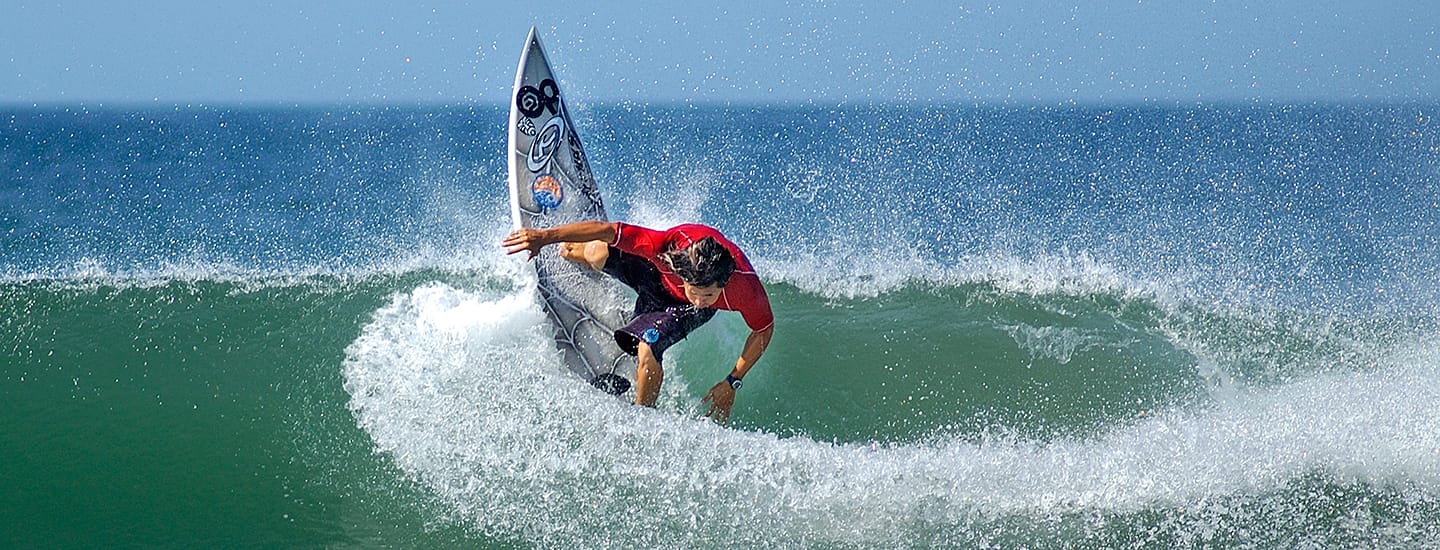
Hermosa Beach
A long, 10-kilometer beach on the open ocean, Hermosa Beach features strong and continuous waves, making it one of Costa Rica’s most preferred surfing beaches and the site of various national competitions. A wide variety of services is available.
-
Esterillos Beach
At 6.8 kilometers long, this beach is named after its numerous estuaries (esterillos is Spanish for “little estuaries”). It is divided into two sections: Esterillos Este (east) and Esterillos Oeste (west). The latter features a rocky coast at its north end. Both beaches are ideal for enjoying the ocean, though the waves are strong and constant. Surfing is possible at Esterillos Oeste.
-
Bejuco Beach
Just to the south, Bejuco Beach is an extension of Esterillos Este and features similar conditions. A popular place for fishing, the long beach is also great for walking and horseback riding, photography, sunbathing and relaxing swims in the ocean.
-
Palma Beach
Also known as “La Bandera,” this beach is located less than 10 kilometers from Parrita. It features a large number of palm trees and strong surf, requiring caution when swimming. At its south end is the mouth of the Parrita River, a popular place for fishing.
-
Palo Seco Beach
This considerably long beach is excellent for sunbathing, walking along the shore and other activities. A wide estuary practically surrounds it and, together with the ocean, forms Palo Seco Island.
-
Palo Seco Estuary
This estuary’s excellent climate and environment make it highly favorable for fishing, waterskiing, boat trips and regattas.
-
Ladies’ Mangroves (Manglares De Damas)
These mangrove swamps may be toured by boat or kayak. During the trip, visitors will be delighted to observe the unique flora and fauna, particularly white-faced monkeys and an infinite number of birds.
-
Ladies’ Caverns (Cavernas De Damas)
These caverns are part of a 500-hectare tract set aside to protect the premontane forest. The caves contain rooms of different sizes with stalactite and stalagmite formations.
-
Rainmaker Canopy Walk
Located on a private preserve in the Fila Chonta mountain range, these bridges are an exceptional attraction thanks to the spectacular scenery enjoyable from their heights.
-
Quepos City
The seat of the Aguirre canton, Quepos maintains an important relationship with banana production activities in this part of the country; old Banana Company structures are still preserved to this day. The city offers a variety of accommodation, dining and recreation options, as well as spectacular scenery of the coast. Its wharf serves as a departure point for sport-fishing and recreational boat trips.
-
Boca Vieja Beach
Located in Quepos, this beach is frequented by the city’s residents. It sits between the mouth of the Paquita River and the Boca Vieja, from which it gets its name. Walking along the beach and swimming as well as boat tours on the Paquita River are popular activities.
-
Quepos Point
This is a rocky promontory featuring forested areas and light-sand beaches. From its viewpoints, visitors can take in the beauty of the calm, blue sea. Several hotels are located on the point’s upper elevations, which offer sweeping views of Manuel Antonio National Park and the entire coastal region from Quepos to Esterillos Oeste.
-
Feast Of The Immaculate Conception
This public religious festival is held on December 8 in Quepos. Locals prepare delicious typical foods and celebrate their faith in various religious ceremonies.
-
Espadilla Norte Beach
Espadilla Norte is very popular for swimming and water sports, including surfing, kayaking, boat trips and jet skiing. A variety of visitor services is also available.
-
Savegre River
This clean, clear river is the perfect place for visitors to enjoy whitewater rafting (Class III) or swimming in calmer spots, as well as the lush greenery and many birds along its banks.
-
Naranjo River
Class III and IV rapids make running this river exciting, while varied landscapes from wooded areas to African palm plantations delight the eye.
-
Savegre Beach
Stretching straight for 11 kilometers between the mouths of the Naranjo and Savegre rivers, this beach is suitable for surfing and other beach activities including sunbathing, walking or just relaxing. The Estero Negro (“Black Estuary”) sits at the mouth of the Naranjo River. Isla Mogote may be seen from the beach.
-
Matapalo Beach
More than eight kilometers long, this beach offers a beautiful and desolate section of coastline. From the beach, the nearby Fila Costeña mountains can be seen. At the north end of the beach, Isla Mogote and Punta Serrucho in Manual Antonio National Park may be seen in the distance.
-
Baru Beach
This long beach is surrounded by a lush natural landscape made up of forest and mangrove swamp. Near the beach is Hacienda Baru, a private nature preserve where visitors can take canopy tours to observe the rich biodiversity. Olive ridley and hawksbill turtles nest on this beach from September to October.